Flood Insurance Oregon Key Guidelines And Insights

Table of Contents
- Regulatory and Legal Framework for Flood Insurance in Oregon
- Federal and State Legal Foundations for Flood Insurance in Oregon
- Comparison of Oregon’s Floodplain Regulations with Neighboring States
- Process for Determining Flood Zones in Oregon
- Types of Flood Insurance Policies Available in Oregon
- Distinctions Between NFIP and Private Flood Insurance in Oregon
- Additional Endorsements and Riders for NFIP Policies in Oregon
- Oregon-Specific Flood Insurance Policies: Farm Bureau and Local Mutual Insurers
- Risk Assessment and Flood Vulnerability in Oregon
- Top 5 Flood-Prone Cities and Regions in Oregon
- Geographic Influences on Flood Risk in Oregon
- Methodology for Calculating Financial Impact of Flooding on Properties
- Frequency and Severity of Flood Events in Oregon (2013–2023)
Oregon’s vulnerability to flooding—ranging from coastal surges to riverine overflows—demands a nuanced understanding of flood insurance mechanisms to safeguard property and mitigate financial risks. With the National Flood Insurance Program (NFIP) and state-specific regulations shaping compliance, property owners must navigate complex legal frameworks, policy distinctions, and risk assessments to ensure adequate coverage. This overview examines Oregon’s regulatory landscape, policy options, and emerging vulnerabilities, providing actionable insights for residents, insurers, and policymakers alike.
The interplay between federal mandates and local enforcement in Oregon creates a unique ecosystem where floodplain management, insurance requirements, and geographic risks converge. From the Columbia River’s floodplain in Portland to Tillamook County’s coastal exposure, stakeholders must align with FEMA’s Flood Insurance Rate Maps while addressing Oregon-specific challenges, such as urban drainage inefficiencies and climate-driven flood intensification. This discussion dissects the legal obligations, policy variations, and financial implications of flood insurance in Oregon, equipping readers with the knowledge to make informed decisions in high-risk environments.
Regulatory and Legal Framework for Flood Insurance in Oregon
Oregon’s flood insurance landscape is governed by a dual framework of federal and state regulations, with the National Flood Insurance Program (NFIP) under the Federal Emergency Management Agency (FEMA) serving as the primary mechanism for risk mitigation. State-specific mandates, such as Oregon’s Floodplain Management Program (OAR 918-050), complement federal requirements by imposing additional standards for floodplain development, insurance compliance, and enforcement. Understanding these layers is critical for property owners, local governments, and insurers to ensure adherence to legal obligations and minimize flood-related financial and structural risks.The interplay between federal and state laws ensures that Oregon’s floodplain management aligns with national disaster preparedness goals while addressing regional vulnerabilities. Below, the regulatory structure, comparative state approaches, flood zone determination processes, and legal obligations for property owners are examined in detail.
Federal and State Legal Foundations for Flood Insurance in Oregon
The National Flood Insurance Program (NFIP), established under the National Flood Insurance Act of 1968, provides standardized flood insurance policies for properties within participating communities. Oregon’s participation in the NFIP is mandatory for localities to qualify for federal disaster relief funding, as outlined in 44 CFR Part 60 (FEMA’s NFIP regulations). Key federal provisions include:At the state level, Oregon’s Oregon Administrative Rules (OAR) Chapter 918, Division 50 establishes the Floodplain Management Program, which:
Key Statutory References:
Comparison of Oregon’s Floodplain Regulations with Neighboring States
Oregon’s floodplain management framework shares foundational similarities with Washington and California but incorporates unique enforcement mechanisms and local adaptations. Below is a structured comparison of key regulatory differences:| Regulatory Aspect | Oregon (OAR 918-050) | Washington (WAC 352-100) | California (CEQA & Local Ordinances) |
|---|---|---|---|
| NFIP Participation Status | Mandatory for all localities; strict compliance. | Mandatory; additional state-level incentives. | Mandatory; state supplements with California Flood Protection Act (CFPA). |
| Local Floodplain Ordinance Authority | Counties/cities may exceed FEMA minimums (e.g., stricter elevation standards). | Localities adopt FEMA standards but may add conditions (e.g., King County’s Critical Areas Ordinance). | Counties implement Local Coastal Programs (LCP) with state oversight; often stricter than FEMA (e.g., Los Angeles’ Flood Control District). |
| Enforcement Penalties | Fines up to $1,000/day for violations; permit revocation. | Administrative penalties; $500–$2,500/day for non-compliance. | Civil penalties up to $10,000 (California Public Resources Code §21168); mandatory retrofitting in high-risk zones. |
| Elevation Standards | 1–2 feet above BFE in SFHAs; dry floodproofing allowed in some cases. | 1–3 feet above BFE; freeboard required in high-velocity zones. | 2–3 feet above BFE in Coastal Zone; mandatory elevation for new construction in SFHAs. |
| Floodplain Mapping Updates | Relies on FEMA FIRMs but allows local supplements (e.g., Lane County’s 2022 Digital Flood Insurance Rate Database (DFIRM)). | Washington State Department of Ecology maintains Floodplain Management Manual; integrates LiDAR data. | California’s Floodplain Mapping and Assessment Program (FMAP) uses high-resolution LiDAR; statewide flood hazard zones exceed FEMA designations. |
| Post-Disaster Recovery Funding | Eligible for FEMA Public Assistance (PA) grants if compliant. | Washington State Emergency Management Division (EMD) supplements FEMA funds. | California’s Severe Weather Response Teams (SWRT) prioritize compliance checks post-disaster; state-funded buyouts for repetitive-loss properties. |
Process for Determining Flood Zones in Oregon
Flood zone designations in Oregon are primarily derived from FEMA’s Flood Insurance Rate Maps (FIRMs), but local governments may supplement these with high-resolution assessments to reflect regional hydrological data. The process involves:1. FEMA’s FIRM Development
2. Local County Assessments
3. Flood Zone Designation Categories
FEMA’s FIRMs classify flood zones as follows (with Oregon-specific notes):
| Zone | Risk Level | Oregon-Specific Requirements |
|---|---|---|
| A/A1-A30 | Moderate-to-high risk (1% annual chance flood) | Mandatory flood insurance if property is financed; elevation permits required for new construction. |
| AE | High-risk (1% annual chance flood) | 1-foot freeboard above BFE; wet floodproofing permitted for non-residential structures. |
| AH | Moderate high-risk (shallow flooding) |
Types of Flood Insurance Policies Available in Oregon
Flood insurance in Oregon is structured around two primary frameworks: the National Flood Insurance Program (NFIP) and private flood insurance policies. Each offers distinct coverage options, exclusions, and cost structures tailored to Oregon’s unique flood risks, including coastal inundation, riverine flooding, and urban drainage challenges. Understanding these differences is critical for residents and businesses to select appropriate protection, particularly in high-risk zones such as Multnomah, Clackamas, and Tillamook counties, where premiums and coverage nuances vary significantly from national averages.The NFIP serves as the federal baseline for flood insurance, while private insurers—including local mutual companies and Farm Bureau—provide alternative or supplementary coverage with varying terms. Additional endorsements under NFIP policies further customize protection, addressing specific Oregon-related vulnerabilities such as elevated utilities or increased dwelling limits. Below, the distinctions between these policies, their cost implications, and procedural requirements for acquisition are detailed, alongside common misconceptions clarified through evidence-based insights.
Distinctions Between NFIP and Private Flood Insurance in Oregon
The National Flood Insurance Program (NFIP), administered by FEMA, offers standardized policies available to property owners in participating communities, including all Oregon counties. NFIP policies are underwritten by the federal government and distributed through private insurance agents or directly via FEMA-approved providers. Key characteristics include:Private flood insurance policies, offered by insurers like Farm Bureau Mutual Insurance Company, Chubb, or The Flood Insurance Agency, provide alternatives with potentially broader coverage or higher limits. These policies often include:
Cost Comparison in High-Risk Oregon Counties:
Premiums in Oregon’s flood-prone counties often surpass national averages due to localized risks. According to FEMA data (2023) and private insurer reports:
Additional Endorsements and Riders for NFIP Policies in Oregon
NFIP policies in Oregon can be augmented with endorsements to address specific vulnerabilities, particularly in regions prone to coastal flooding, urban drainage failures, or riverine overflows. Available endorsements include:- Increased Dwelling Coverage (Maximum Coverage Modification - MCM)
- Separate Utilities Coverage
- Additional Living Expenses (ALE) Extension
- Mold Remediation Coverage
- Valuable Articles Endorsement
Note: Endorsements are subject to FEMA approval and may not be available in all flood zones. Agents should verify eligibility based on the property’s Flood Insurance Rate Map (FIRM) designation.
Oregon-Specific Flood Insurance Policies: Farm Bureau and Local Mutual Insurers
Beyond NFIP and national private insurers, Oregon residents can access regionally tailored flood insurance through:- Local Mutual Insurers (e.g., Oregon Mutual Insurance Company)
-
Risk Assessment and Flood Vulnerability in Oregon
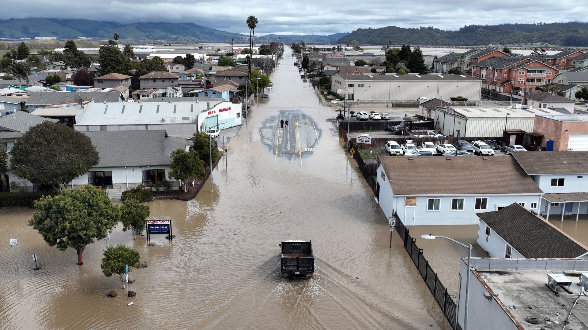
Oregon’s flood risk landscape is shaped by its diverse geography, ranging from coastal storm surges and riverine overflows to urban drainage challenges exacerbated by climate change. Historical flood events, such as the 2021 atmospheric river-driven floods in the Willamette Valley and the 1996 Columbia River flood in Portland, demonstrate the state’s vulnerability. This section examines Oregon’s most flood-prone regions, the influence of its unique topography on flood dynamics, and the financial and operational impacts of flooding on properties and critical industries. Data from state agencies, climate models, and economic analyses provide a foundation for understanding exposure, risk mitigation strategies, and the role of regulatory bodies like the Oregon Department of Geology and Mineral Industries (DOGAMI).
Oregon’s flood risk is further amplified by its geographic diversity, including mountainous terrain that accelerates snowmelt, low-lying coastal plains susceptible to storm surges, and urbanized areas with aging infrastructure struggling to manage increased rainfall. The state’s flood vulnerability is not uniform; certain cities and regions experience higher frequencies of flooding due to their proximity to major water bodies, elevation gradients, and land-use patterns. Below, the top flood-prone areas are identified, followed by an analysis of Oregon’s flood types, their economic consequences, and the methodologies employed to assess and mitigate these risks.
Top 5 Flood-Prone Cities and Regions in Oregon
Oregon’s flood risk varies significantly by region, with coastal areas, river floodplains, and urban centers facing distinct threats. The following cities and regions are identified as the most vulnerable based on historical flood data, climate projections, and infrastructure exposure:1. Portland and the Lower Willamette Valley
The Portland metropolitan area, centered along the Columbia and Willamette Rivers, is highly susceptible to riverine flooding due to its proximity to major waterways and urban sprawl into floodplains. The 2021 atmospheric river event, which caused the Willamette River to exceed its banks and flood downtown Portland, resulted in over $100 million in damages. Climate models project increased rainfall intensity in winter months, exacerbating flood risks in this densely populated region.
2. Coos Bay and the South Coast
Coastal flooding in Coos Bay is driven by storm surges, high tides, and wave action, particularly during winter storms. The 2007 "New Year’s Eve Storm" caused significant erosion and flooding in coastal communities, displacing residents and damaging infrastructure. Rising sea levels and increased storm frequency are expected to intensify these risks, threatening agricultural lands and critical coastal highways.
3. Eugene and the Middle Willamette Valley
Eugene’s flood vulnerability stems from its location in the Willamette River floodplain and the urban drainage challenges posed by its hilly terrain. The 1996 flood, which submerged parts of downtown Eugene, highlighted the city’s exposure to both riverine and flash flooding. Climate projections indicate a 20–30% increase in heavy precipitation events by 2050, elevating flood risks for residential and commercial properties.
4. Hood River and the Columbia River Gorge
The Hood River Valley is prone to flash flooding due to its steep topography and rapid snowmelt from Mount Hood. The 2006 flood, triggered by heavy rainfall and snowmelt, inundated the town and disrupted regional agriculture. Future climate scenarios suggest more frequent extreme precipitation events, increasing the likelihood of similar floods.
5. Corvallis and the Lower Marys River Basin
Corvallis faces flooding from the Marys River and its tributaries, particularly during winter storms. The 2009 flood, which damaged homes and agricultural lands, demonstrated the vulnerability of the region’s infrastructure. Urbanization and land-use changes have reduced natural floodwater absorption, amplifying flood risks in this agricultural and educational hub.
Geographic Influences on Flood Risk in Oregon
Oregon’s topography and climate create a complex flood risk profile, with distinct mechanisms driving flooding across the state. The following geographic factors contribute to the variability and severity of flood events:- Coastal Storm Surges and Tidal Flooding
Oregon’s 363-mile coastline is exposed to Pacific storm surges, which combine with high tides to inundate low-lying areas. Coastal communities, such as Newport and Brookings, experience tidal flooding during king tides and extreme weather events. The combination of rising sea levels and increased storm intensity is projected to worsen these conditions, threatening coastal roads, wetlands, and agricultural lands.
- Riverine Flooding from Snowmelt and Rainfall
Oregon’s mountainous regions, including the Cascade Range and the Blue Mountains, act as natural reservoirs, releasing water during snowmelt or heavy rainfall. Rivers like the Columbia, Willamette, and Umpqua are prone to overflowing their banks, particularly in spring and winter. Urban areas along these rivers, such as Portland and Salem, face elevated risks due to impervious surfaces that accelerate runoff.
- Urban Drainage Challenges
Rapid urbanization in cities like Portland and Eugene has reduced the capacity of natural drainage systems, leading to localized flooding during heavy rainfall. Aging stormwater infrastructure and inadequate retention ponds exacerbate these issues, particularly in low-lying neighborhoods. Climate projections indicate a 15–25% increase in extreme precipitation events by 2080, further straining urban drainage systems.
- Flash Flooding in Mountainous and Canyon Regions
Steep terrain in areas like the Columbia River Gorge and the Rogue Valley amplifies the risk of flash flooding. Heavy rainfall or rapid snowmelt can overwhelm small watersheds, leading to sudden and destructive floods. Hood River and Baker City are particularly vulnerable, with historical events demonstrating the potential for catastrophic damage to infrastructure and agriculture.
Methodology for Calculating Financial Impact of Flooding on Properties
Assessing the financial impact of flooding on properties in Oregon requires a structured approach that accounts for property value, replacement costs, deductibles, and regional flood risk factors. The following methodology provides a framework for estimating potential losses:1. Property Value and Flood Zone Classification
The Federal Emergency Management Agency (FEMA) flood zone designation (e.g., Zone A, V, or X) determines the baseline flood risk for a property. Higher-risk zones (e.g., Special Flood Hazard Areas, or SFHAs) incur higher insurance premiums and potential financial exposure. Property values in flood-prone areas are often adjusted downward by real estate markets to reflect increased risk.
2. Replacement Cost Valuation
The replacement cost of a property is calculated based on current construction costs, materials, and labor rates. For flood-damaged properties, this includes:
3. Deductible Structures and Insurance Coverage
Flood insurance policies typically include deductibles, which are subtracted from the claim amount before reimbursement. For example:
4. Formula for Estimated Financial Impact
The potential financial impact (F) of flooding on a property can be approximated using the following formula:
F = (Replacement Cost × Flood Damage Percentage) – (Insurance Payout – Deductible)Where:
Example Calculation:
A home in Portland with a replacement cost of $500,000 experiences 50% flood damage ($250,000). With a $5,000 deductible and $250,000 NFIP coverage:
F = ($500,000 × 0.50) – ($250,000 – $5,000) = $250,000 – $245,000 = $5,000 (out-of-pocket expense).However, if the damage exceeds policy limits, the homeowner bears the remaining costs.
Frequency and Severity of Flood Events in Oregon (2013–2023)
Over the past decade, Oregon has experienced a range ofFlood insurance in Oregon is not merely a regulatory obligation but a critical tool for resilience in the face of escalating flood risks. By adhering to state and federal guidelines, leveraging tailored policy options, and proactively assessing vulnerabilities, property owners can mitigate financial exposure while supporting broader community preparedness. As climate models project heightened flood frequencies, Oregon’s approach—balancing strict enforcement with innovative mitigation—serves as a model for regions grappling with similar challenges. Ultimately, informed decision-making today ensures long-term protection for both assets and livelihoods in Oregon’s diverse flood-prone landscapes.
Leave a Comment
Comments are moderated before appearing. The data you submit is processed according to the Privacy Policy of viralcontentbee.com.